Services
We offer fast and reliable services that support a wide range of development types at every stage of the planning and design process. Our services are tailored to the specific needs of each project, ensuring the best possible outcomes. Please find a brief overview of our core services below, and refer to our capability statement to learn more about our approach and what sets us apart.
PHOTOMONTAGES
A photomontage is a visual representation that combines a photograph of an existing view with a realistic depiction of a proposed development, showing how the project will appear once built. This imagery is used to illustrate various development scenarios that inform stakeholders and authorities about the visual impact of a potential development.
Features:
Accurate Imagery: Photomontages are prepared using advanced modelling techniques to ensure the imagery is accurate.
Survey Verification: Modelling is validated by survey information provided by a surveyor or prepared by Veew Studio.
Versatile Application: Photomontages are utilised in visual impact assessments for development applications, environmental impact assessments, development appeals, as evidence for court cases and much more.
Compliant: All photomontages are prepared in accordance with the relevant planning authority policy (see the NSW Land and Environment Court Policy here).
Double tap play before/after video
DIGITAL MONTAGES
A term coined by Veew Studio, digital montages are computer-generated images that replicate real-world views using 3D models. Developed in-house, our process leverages the latest technology and techniques to deliver highly accurate representations of proposed developments.
Features:
Accessible: Digital montages are particularly useful for projects where taking photos with a camera is not possible, such as in inaccessible locations or during early design stages.
Efficient: A faster process than photomontages when there is a need to assess views from a large number of vantage points.
Early-Stage Application: Digital montages can be used in the early stages of a project to guide design or for visual impact assessments when lodging a development application.
Double tap play before/after video
VISUAL IMPACT ASSESSMENTS
While our primary focus is on producing accurate, high-quality imagery, we also provide the accompanying reporting when required, either independently or in collaboration with planning or landscape consultants. These reports are tailored to suit the type and scale of development, and are prepared to meet the expectations of planning authorities, community stakeholders, or the NSW Land and Environment Court.
We offer three core report types:
1. View Impact Assessment – Private Property
These reports assess the impact of a proposed development on views from neighbouring private properties, with reference to established planning principles and supported by survey-informed visuals. Features include:
Assessment of view loss using the Tenacity Planning Principle.
Structured evaluation of the extent, nature and reasonableness of view impacts.
Useful for DA applications, DA objections and court appeals.
2. View Impact Assessment – Public Domain
Prepared for developments visible from the public domain, these reports examine the visual effect on streetscapes, parks, foreshores and other shared environments, with a focus on public interest and visual prominence. Features include:
Analysis guided by the Rose Bay Marina Planning Principle.
Identification and assessment of significant public viewing locations.
Consideration of scenic quality, visual character, and urban context.
Commonly prepared to support DA submissions and court matters where compliance with local and state visual impact controls is required.
3. Visual Impact & Landscape Visual Impact Assessments
Used for infrastructure, rezonings or large-scale projects, these reports provide a comprehensive assessment of landscape and visual effects across a broader context. Features include:
Structured methodology based on the Transport for NSW Guideline for landscape character and visual impact assessment and relevant environmental planning policies.
Assessment of landscape character, visual sensitivity, and magnitude of change.
Consideration of design integration, mitigation measures, and cumulative impacts.
Prepared to support Environmental Impact Statements, strategic plans, or infrastructure applications.
Double tap play before/after video
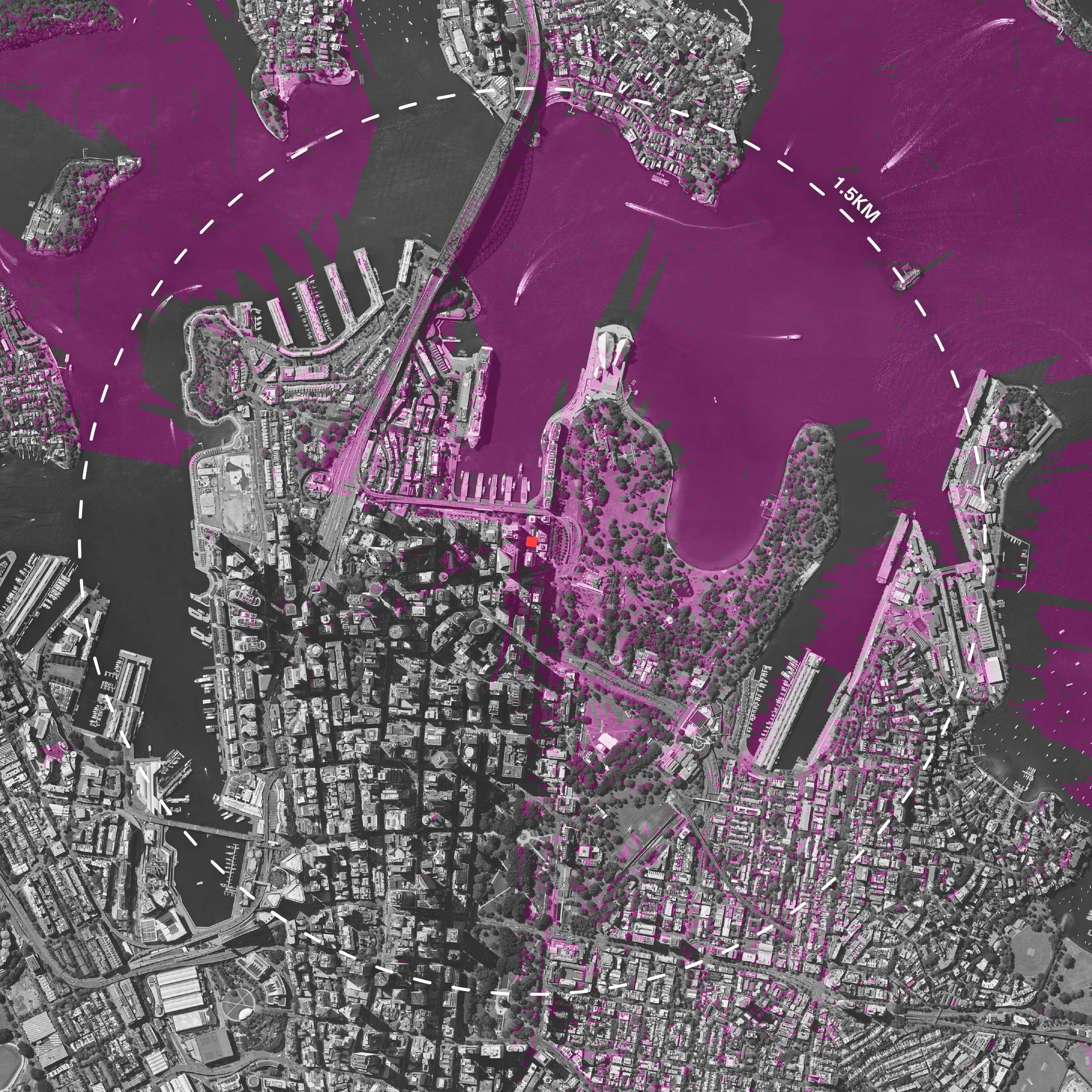
Viewshed Map of the Proposed Development Above

